The Work Package 6 (WP6) of LEVITATE considers the specific case of passenger cars which are used across the transport system so forecasting of impact will consider the use on urban, rural and highway infrastructure. Work undertaken in WP6 is based on the methodology developed in WP3 and the scenarios developed in WP4 to identify and test specific scenarios regarding the impacts of CATS on passenger cars. Findings will complement those of WP5 (Urban transport) and WP7 (Freight transport) and feed into the developing of the LEVITATE Policy Support Tool (PST) in WP8. The aim of this WP6 is to forecast short-, medium- and, long-term impacts of automated passenger cars on safety, mobility, environment, economy and society. The objectives of the WP6 are set as follow:
- To identify how each area of impact (safety, environment, economy and society) will be affected by the transition of passenger cars into connected and automated transport systems (CATS). Impacts on traffic will be considered cross-cutting across the other dimensions,
- To assess the short-, medium- and long-term impacts, benefits and costs of cooperative and automated driving systems for passenger cars,
- To test interactions of the examined impacts in passenger cars, and
- To prioritise considerations for a public toolkit to help authority decisions.
According to Deliverable 3.1, a taxonomy of potential impacts of connected and automated transport systems (CATS) at different levels of implementation can be classified into three distinct categories: direct impacts refer to the operation of connected and automated transport systems by each user; systemic impacts are system-wide impacts on transport; and wider impacts are societal impacts resulting from changes in the transport system such as accessibility and cost of transport, and impacts like accidents and pollution and changes in land use and employment. In order to estimate and forecast these impacts, appropriate assessment methods have been proposed in LEVITATE such as traffic mesoscopic simulation, traffic microsimulation, system dynamics, Backcasting and Delphi panel method.
A stakeholder reference group workshop was conducted to gather views from city administrators and industry on the future of CATS and possible uses (i.e. use cases) of automated passenger cars, named, sub-use cases. Workshop participants suggested a few new use cases for passenger cars. Those include specific detailed parking related sub-use cases and in-vehicle signage. It was emphasised that in order to have a better future of AVs, parking issues would need to be solved. Within WP6, five sub-use cases have been defined as follows:
- Road use pricing:
- Empty km pricing
- Static toll on all vehicles
- Dynamic toll on all vehicles
- Automated ride sharing
- Parking space regulation:
- Parking price
- Replace on-street parking with public space
- Replace on-street parking with driving lanes
- Replace on-street parking with pick-up/drop-off parking
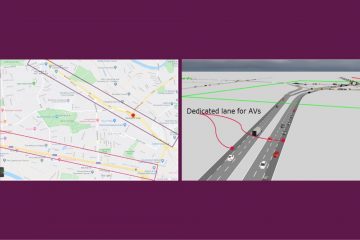
- Provision of dedicated lanes for AVs on urban highways, and
- Green Light Optimal Speed Advisory (GLOSA).
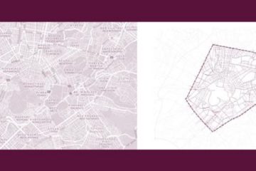
This article will be focused on the initial findings by applying the traffic microsimulation for sub-use cases, specifically the initial findings of the provision of dedicated lanes for AVs on urban highways and parking price. It noted that all autonomous vehicles are electric and that they used two main driving profiles (Roussou et al., 2019):
- Cautious: long clearance in car-following, long anticipation distance for lane selection, long clearance in gap acceptance in lane changing, limited overtaking, no cooperation, long gaps, and
- Aggressive: short clearance in car-following, short anticipation distance for lane selection, short clearance in gap acceptance in lane changing, limited overtaking, no cooperation, small gaps.
Have a look at the whole article, written by Hua Sha (LOUGH), Hitesh Boghani (LOUGH), Amna Chaudhry (LOUGH), Mohammed Quddus (LOUGH), Andrew Morris (LOUGH), Pete Thomas (LOUGH).